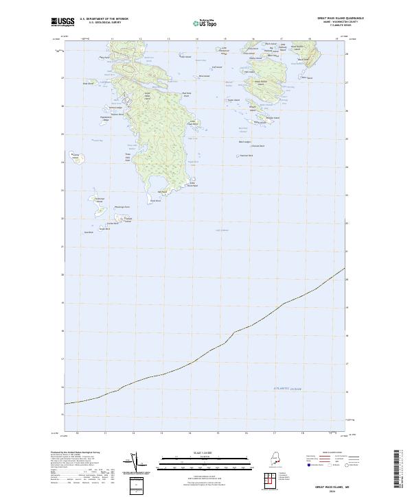
2024 Map of Great Wass Island
USGS Topo · Published 2024About this map
Great Wass Island and its surrounding archipelago dominate this coastal Maine survey, revealing a landscape defined by complex inlets and offshore islands. On the main island, Station Rd and Black Duck Cove Rd provide limited access to the interior, while the southern reaches like Red Head and Little Pond Head remain largely unpaved. The settlement at Mannings Farm sits near the southwestern shore, overlooking a cluster of smaller islands including Crumple Island and Fisherman Island.
Find a feature on this map
67 named features on this map. Tap any name to fly to it.
Don’t see what you’re looking for? This feature index may not catch every label — zoom into the map to look around manually.
Map Details
Editions of this 2024 Great Wass Island Map
This is the sole edition of this map. No revisions or reprints were ever made.
Other maps of this area

1918 · Machias
USGS Topo · 1:62,500

1921 · Great Wass Island
USGS Topo · 1:62,500

1921 · Columbia Falls
USGS Topo · 1:62,500

1941 · Columbia Falls
USGS Topo · 1:62,500

1941 · Machias
USGS Topo · 1:62,500

1942 · Columbia Falls
USGS Topo · 1:62,500

1948 · Jonesport
USGS Topo · 1:24,000

1948 · Roque Bluffs
USGS Topo · 1:24,000

1948 · Drisko Island
USGS Topo · 1:24,000
1948 · Addison
USGS Topo · 1:24,000