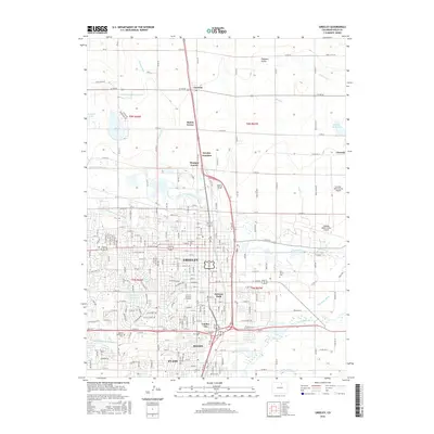
2016 Map of Greeley
USGS Topo · Published 2016About this map
Greeley and the surrounding high plains of Weld County appear here at a point of significant modern expansion, anchored by the University of Northern Colorado and a complex network of agricultural irrigation. The landscape is defined by the convergence of the Cache la Poudre River and the South Platte River, which feed an intricate system of man-made waterways including the Greeley Number 2 Canal and Ogilvy Ditch. This infrastructure highlights the region's transition from a rail-based agricultural hub along the Union Pacific RR to a major regional center. Smaller incorporated areas like Garden City and Evans are shown with their distinct street grids, while several local cemeteries, such as Linn Grove Cem and Evans Cem, provide valuable reference points for genealogists and local historians tracking the development of these communities.
Find a feature on this map
118 named features on this map. Tap any name to fly to it.
Don’t see what you’re looking for? This feature index may not catch every label — zoom into the map to look around manually.
Map Details
Editions of this 2016 Greeley Map
This is the sole edition of this map. No revisions or reprints were ever made.
Other maps of this area

1902 · Greeley
USGS Topo · 1:125,000

1908 · Eaton
USGS Topo · 1:125,000

1910 · Eaton
USGS Topo · 1:125,000

1950 · Greeley
USGS Topo · 1:24,000

1950 · Kersey
USGS Topo · 1:24,000

1950 · Bracewell
USGS Topo · 1:24,000

1950 · Milliken
USGS Topo · 1:24,000

1950 · Valley View School
USGS Topo · 1:24,000

1950 · La Salle
USGS Topo · 1:24,000
1951 · Milliken
USGS Topo · 1:24,000