
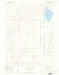
1950 Map of La Salle
USGS Topo · Published 1991About this map
La Salle and Evans serve as the primary hubs in this agricultural and transportation corridor of Weld County, where the Union Pacific railroad parallels the winding course of the South Platte River. The landscape is defined by an intricate network of irrigation infrastructure essential to the region's productivity, including the Latham Ditch, Godfrey Ditch, and the extensive Lower Latham Reservoir. These waterways highlight the engineering required to sustain settlements like East La Salle and Auburn during the mid-century.
Find a feature on this map
32 named features on this map. Tap any name to fly to it.
Don’t see what you’re looking for? This feature index may not catch every label — zoom into the map to look around manually.
Map Details
Editions of this 1950 La Salle Map
This is the sole edition of this map. No revisions or reprints were ever made.
Other maps of this area

1902 · Greeley
USGS Topo · 1:125,000

1949 · Platteville
USGS Topo · 1:24,000

1950 · Greeley
USGS Topo · 1:24,000

1950 · Platteville
USGS Topo · 1:24,000

1950 · Kersey
USGS Topo · 1:24,000

1950 · Bracewell
USGS Topo · 1:24,000

1950 · Milliken
USGS Topo · 1:24,000

1950 · Klug Ranch
USGS Topo · 1:24,000

1950 · Valley View School
USGS Topo · 1:24,000
1950 · Milton Reservoir
USGS Topo · 1:24,000