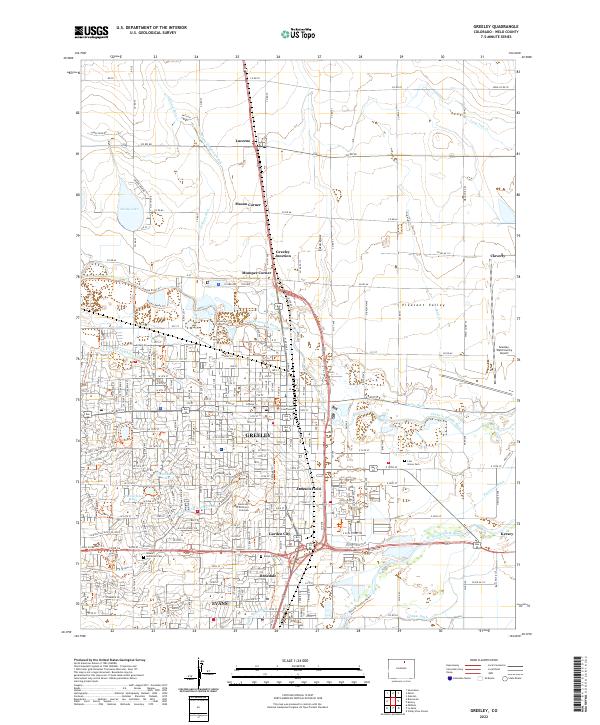
2022 Map of Greeley
USGS Topo · Published 2022About this map
The Greeley area, along with its neighboring communities of Evans, Garden City, and Rosedale, is defined by a complex irrigation network essential to this region of the High Plains. Tracing the legacy of early western water law, the map shows the Greeley Number 2 Ditch, Ogilvy Ditch, and Latham Ditch as they draw from the Cache la Poudre River and South Platte River. These waterways supported the development of outlying settlements like Lucerne and Cloverly and fueled the growth of the University of Northern Colorado at the heart of the city. Historical landmarks, including the Weld County Courthouse and the expansive grounds of Linn Grove Cem, anchor the urban grid. Beyond the city center, the landscape transitions into Pleasant Valley, where older place names like Mumper Corner and Mason Corner mark the rural intersections of Weld County.
Find a feature on this map
41 named features on this map. Tap any name to fly to it.
Don’t see what you’re looking for? This feature index may not catch every label — zoom into the map to look around manually.
Map Details
Editions of this 2022 Greeley Map
This is the sole edition of this map. No revisions or reprints were ever made.
Other maps of this area

1902 · Greeley
USGS Topo · 1:125,000

1908 · Eaton
USGS Topo · 1:125,000

1910 · Eaton
USGS Topo · 1:125,000

1950 · Greeley
USGS Topo · 1:24,000

1950 · Kersey
USGS Topo · 1:24,000

1950 · Bracewell
USGS Topo · 1:24,000

1950 · Milliken
USGS Topo · 1:24,000

1950 · Valley View School
USGS Topo · 1:24,000

1950 · La Salle
USGS Topo · 1:24,000
1951 · Milliken
USGS Topo · 1:24,000