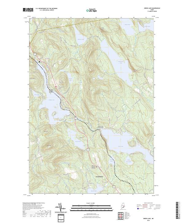
2024 Map of Green Lake
USGS Topo · Published 2024About this map
Green Lake and the rugged surrounding heights of Eagle Bluff and Big Hill dominate this Hancock County landscape, where the town of Ellsworth borders a network of glacial waters. The area is defined by its deep connectivity between the land and its lakes, from the southern reach of Branch Lake to the secluded Hatcase Pond in the north. Settlement is concentrated in pockets such as Lucerne-in-Maine and Wilson Corner, while historical markers like the Pine Trail Cem and Wilson Cem provide essential anchor points for genealogists and local historians.
Find a feature on this map
94 named features on this map. Tap any name to fly to it.
Don’t see what you’re looking for? This feature index may not catch every label — zoom into the map to look around manually.
Map Details
Editions of this 2024 Green Lake Map
This is the sole edition of this map. No revisions or reprints were ever made.
Other maps of this area

1900 · Orland
USGS Topo · 1:62,500

1902 · Orono
USGS Topo · 1:62,500

1911 · Ellsworth
USGS Topo · 1:62,500

1929 · Great Pond
USGS Topo · 1:48,000

1932 · Great Pond
USGS Topo · 1:62,500

1940 · Ellsworth
USGS Topo · 1:62,500

1942 · Orland
USGS Topo · 1:62,500

1942 · Ellsworth
USGS Topo · 1:62,500

1944 · Orono
USGS Topo · 1:62,500

1946 · Orono
USGS Topo · 1:62,500