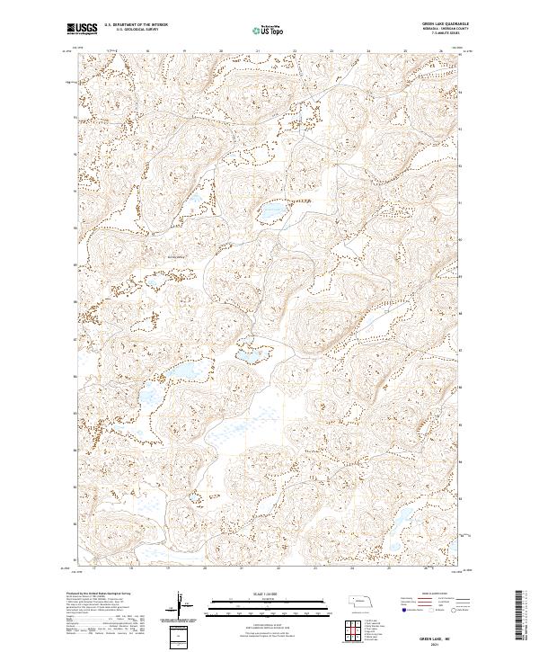
2021 Map of Green Lake
USGS Topo · Published 2021About this map
Survey Valley sits at the heart of this Sheridan County landscape, characterized by the intricate drainage patterns and depressions typical of the Nebraska Sandhills. The area is defined by its numerous small basins and wetlands, with Green Lake and Shane Lake serving as primary geographic anchors in a terrain otherwise dominated by undulating landforms and ephemeral water bodies. This region shows a sparse, remote settlement pattern where human activity is primarily traced through a network of rural routes and trails such as 358 Trl and 281 Trl. These primitive roads follow the natural contours of the valley, reflecting the historical necessity of navigating around the shifting sands and seasonal wetlands of the high plains. The map provides a look at the enduring township and range system, marking boundaries like t27n r43w and t28n r42w that continue to organize this open cattle country.
Find a feature on this map
14 named features on this map. Tap any name to fly to it.
Don’t see what you’re looking for? This feature index may not catch every label — zoom into the map to look around manually.
Map Details
Editions of this 2021 Green Lake Map
This is the sole edition of this map. No revisions or reprints were ever made.
Other maps of this area

1948 · Bingham
USGS Topo · 1:62,500

1948 · Lakeside
USGS Topo · 1:62,500

1948 · Twin Lakes
USGS Topo · 1:62,500

1948 · Spade Ranch
USGS Topo · 1:62,500

1950 · Twin Lakes
USGS Topo · 1:62,500

1950 · Spade Ranch
USGS Topo · 1:62,500

1950 · Lakeside
USGS Topo · 1:62,500

1950 · Bingham
USGS Topo · 1:62,500

1955 · Alliance
USGS Topo · 1:250,000

1957 · Alliance
USGS Topo · 1:250,000