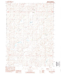
1989 Map of Green Lake
USGS Topo · Published 1989About this map
Survey Valley dominates this Sheridan County landscape, where the sand hills and depressions of the Nebraska panhandle create a patchwork of isolated basins. In the late 1980s, the cattle industry remained the primary engine of the local economy, anchored by large operations like the Berndt Cattle Co Ranch and the Green Valley Cattle Co Ranch. The presence of Sch No 133 in the northern portion of the quadrangle suggests the enduring, albeit sparse, infrastructure required to support remote ranching families. The terrain is characterized by numerous small, often ephemeral-looking water bodies such as Green Lake, Shane Lake, and Star Lake. These features, along with the high point at Argo Hill, represent a specialized environment where water management and grazing rights defined land use for generations of Nebraska homesteaders and their descendants.
Find a feature on this map
12 named features on this map. Tap any name to fly to it.
Don’t see what you’re looking for? This feature index may not catch every label — zoom into the map to look around manually.
Map Details
Editions of this 1989 Green Lake Map
This is the sole edition of this map. No revisions or reprints were ever made.
Other maps of this area

1948 · Bingham
USGS Topo · 1:62,500

1948 · Lakeside
USGS Topo · 1:62,500

1948 · Twin Lakes
USGS Topo · 1:62,500

1948 · Spade Ranch
USGS Topo · 1:62,500

1950 · Twin Lakes
USGS Topo · 1:62,500

1950 · Spade Ranch
USGS Topo · 1:62,500

1950 · Lakeside
USGS Topo · 1:62,500

1950 · Bingham
USGS Topo · 1:62,500

1955 · Alliance
USGS Topo · 1:250,000

1957 · Alliance
USGS Topo · 1:250,000