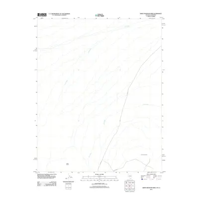
2012 Map of Green Monster Mine
USGS Topo · Published 2012About this map
The Green Monster Mine stands as a primary landmark in this arid Clark County landscape, illustrating the industrial footprint within the Spring Mountains region. The terrain is defined by complex drainage patterns, with the primary channels of Lovell Wash and Potosi Wash carving through the desert floor towards the south. In the southwestern corner, the elevation of Black Butte provides a distinct geographic anchor. While the area is largely undeveloped, the presence of thoroughfares like Palrump Rd and Tuskegee St near the southern boundary indicates the encroachment of local infrastructure upon the traditional mining and desert lands. This survey captures a moment where industrial history and modern transit intersect in the Nevada high desert.
Find a feature on this map
6 named features on this map. Tap any name to fly to it.
Don’t see what you’re looking for? This feature index may not catch every label — zoom into the map to look around manually.
Map Details
Editions of this 2012 Green Monster Mine Map
This is the sole edition of this map. No revisions or reprints were ever made.
Other maps of this area

1907 · Las Vegas
USGS Topo · 1:250,000

1908 · Las Vegas
USGS Topo · 1:250,000

1910 · Ivanpah
USGS Topo · 1:250,000

1912 · Ivanpah
USGS Topo · 1:250,000

1942 · Ivanpah
USGS Topo · 1:250,000

1947 · Kingman
USGS Topo · 1:250,000

1948 · Kingman
USGS Topo · 1:250,000

1954 · Las Vegas
USGS Topo · 1:250,000

1954 · Kingman
USGS Topo · 1:250,000

1955 · Kingman
USGS Topo · 1:250,000