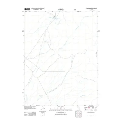
2012 Map of Green Springs
USGS Topo · Published 2012About this map
Green Springs serves as the focal point of this arid White Pine County landscape, situated where Co RD 5 cuts through the high desert. The area is defined by its vital water sources and drainage patterns, most notably the Green Springs Reservoir and the network of seasonal channels that carve the terrain. Deeply etched drainages like the Lampson Canyon Wash and Freeland Canyon Wash illustrate the erosive power of occasional runoff from the surrounding peaks. Smaller watering holes such as Birch Spring and Mustang Spring provide localized relief in an otherwise dry environment. The convergence of these washes at the mouths of Lampson Canyon and Freeland Canyon reveals a traditional western land use pattern, where life and transit are dictated by the presence of reliable springs and the natural corridors through the mountains.
Find a feature on this map
10 named features on this map. Tap any name to fly to it.
Don’t see what you’re looking for? This feature index may not catch every label — zoom into the map to look around manually.
Map Details
Editions of this 2012 Green Springs Map
This is the sole edition of this map. No revisions or reprints were ever made.
Other maps of this area

1949 · Treasure Hill
USGS Topo · 1:62,500

1950 · Treasure Hill
USGS Topo · 1:62,500

1951 · Green Springs
USGS Topo · 1:62,500

1956 · Lund
USGS Topo · 1:250,000

1956 · Ely
USGS Topo · 1:250,000

1957 · Currant Mtn
USGS Topo · 1:62,500

1959 · Ely
USGS Topo · 1:250,000

1960 · Lund
USGS Topo · 1:250,000

1963 · Ely
USGS Topo · 1:250,000

1964 · Duckwater
USGS Topo · 1:62,500