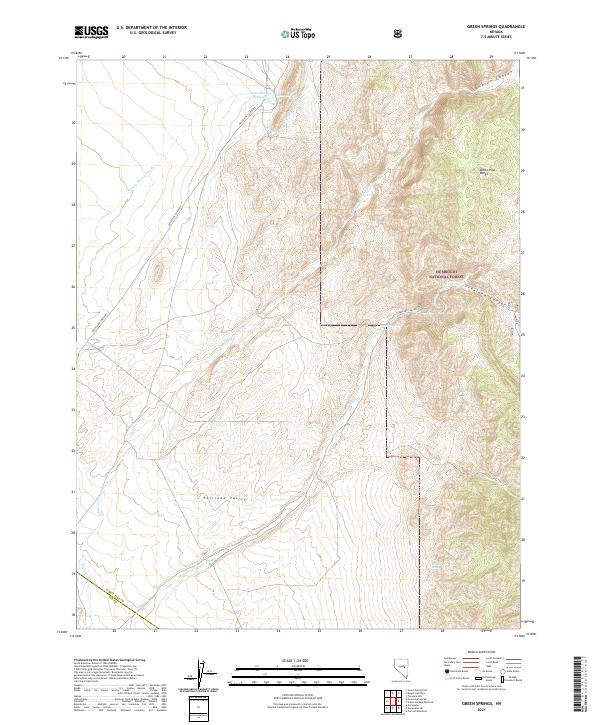
2021 Map of Green Springs
USGS Topo · Published 2021About this map
Green Springs Reservoir sits at the northern edge of this high-desert landscape, serving as a primary water source where Green Springs Wash and several other drainages converge. The topography is dominated by the steep slopes of the White Pine Range, which rise sharply above the eastern reaches of the expansive Railroad Valley. Within the protected boundaries of the Humboldt National Forest, the terrain is carved by deep geographic features like Lampson Canyon and Freeland Canyon. Remote water sources such as Mustang Spring and Birch Spring provide critical points of interest for those studying the arid hydrology of this region. The map also documents the administrative boundary at White Pine Co Nye Co, where White Pine Co Road 5 provides the principal overland access across the basin floor.
Find a feature on this map
24 named features on this map. Tap any name to fly to it.
Don’t see what you’re looking for? This feature index may not catch every label — zoom into the map to look around manually.
Map Details
Editions of this 2021 Green Springs Map
This is the sole edition of this map. No revisions or reprints were ever made.
Other maps of this area

1949 · Treasure Hill
USGS Topo · 1:62,500

1950 · Treasure Hill
USGS Topo · 1:62,500

1951 · Green Springs
USGS Topo · 1:62,500

1956 · Lund
USGS Topo · 1:250,000

1956 · Ely
USGS Topo · 1:250,000

1957 · Currant Mtn
USGS Topo · 1:62,500

1959 · Ely
USGS Topo · 1:250,000

1960 · Lund
USGS Topo · 1:250,000

1963 · Ely
USGS Topo · 1:250,000

1964 · Duckwater
USGS Topo · 1:62,500