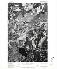
1975 Map of Greenacres NE
USGS Topo · Published 1981About this map
Spokane River cuts through the center of this 1970s orthophotoquad, tracing the border region where Washington meets Idaho. This unique photographic survey, produced in cooperation with the Bureau of Indian Affairs, provides a stark visual record of the landscape during a period of transition. The orthophotograph highlights the sharp contrast between the geometric grid of agricultural fields near Newman Lake and the dark, forested slopes surrounding Liberty Lake to the south. Small settlements like State Line Village and Hauser are visible along the major transportation corridors that parallel the river, showing the layout of homes and roads as they existed decades ago. This imagery-based map offers a rare perspective on local land use, from large-scale farming to the concentrated development along the interstate and rail lines.
Find a feature on this map
5 named features on this map. Tap any name to fly to it.
Don’t see what you’re looking for? This feature index may not catch every label — zoom into the map to look around manually.
Map Details
Editions of this 1975 Greenacres NE Map
This is the sole edition of this map. No revisions or reprints were ever made.
Other maps of this area

1901 · Spokane
USGS Topo · 1:125,000

1903 · Rathdrum
USGS Topo · 1:125,000

1943 · Mt Spokane
USGS Topo · 1:62,500

1949 · Greenacres
USGS Topo · 1:62,500

1950 · Mt Spokane
USGS Topo · 1:62,500

1951 · Greenacres
USGS Topo · 1:62,500

1955 · Spokane
USGS Topo · 1:250,000

1957 · Coeur D'Alene
USGS Topo · 1:62,500

1958 · Spokane
USGS Topo · 1:250,000

1961 · Rathdrum
USGS Topo · 1:24,000