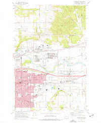
1973 Map of Greenacres
USGS Topo · Published 1977About this map
Opportunity, Veradale, and Greenacres form a dense corridor of development along the valley floor in the early 1970s, illustrating the suburban transformation of the region east of the city. The landscape is defined by a rigorous grid of schools and infrastructure, including the massive Spokane Industrial Park at Velox and the regional Spokane Valley Hospital. North of the Spokane River, the terrain rises sharply toward Antoine Peak, where the residential grid gives way to Pleasant Prairie and the deep cuts of Bigelow Gulch. Local heritage is preserved at the Antoine Plante Ferry Site Park along the river, marking an era before modern bridges and Interstate 90 reorganized the valley's transit. Industrial and community markers like the Inland Empire Zoo and numerous neighborhood schools like Mc Donald Sch provide specific touchpoints for local historians.
Find a feature on this map
70 named features on this map. Tap any name to fly to it.
Don’t see what you’re looking for? This feature index may not catch every label — zoom into the map to look around manually.
Map Details
Editions of this 1973 Greenacres Map
2 editions found
Other maps of this area

1901 · Spokane
USGS Topo · 1:125,000

1943 · Mt Spokane
USGS Topo · 1:62,500

1949 · Deer Park
USGS Topo · 1:62,500

1949 · Greenacres
USGS Topo · 1:62,500

1950 · Spokane NE
USGS Topo · 1:24,000

1950 · Spokane SE
USGS Topo · 1:24,000

1950 · Mt Spokane
USGS Topo · 1:62,500

1950 · Spokane
USGS Topo · 1:62,500

1951 · Deer Park
USGS Topo · 1:62,500

1951 · Greenacres
USGS Topo · 1:62,500