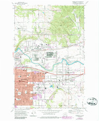
1973 Map of Greenacres
USGS Topo · Published 1985About this map
Spokane River defines the central geography of this valley as it flows westward through a landscape rapidly transitioning from agricultural use to industrial and suburban development. The northern section is dominated by the high ground of Antoine Peak and the expanse of Pleasant Prairie, while the valley floor below exhibits the massive footprint of the Spokane Industrial Park at Velox. Historically significant sites like the Antoine Plante Ferry Site Park sit near modern additions like the Inland Empire Zoo.
Find a feature on this map
65 named features on this map. Tap any name to fly to it.
Don’t see what you’re looking for? This feature index may not catch every label — zoom into the map to look around manually.
Map Details
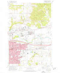
Editions of this 1973 Greenacres Map
2 editions found
Other maps of this area

1901 · Spokane
USGS Topo · 1:125,000

1943 · Mt Spokane
USGS Topo · 1:62,500

1949 · Deer Park
USGS Topo · 1:62,500

1949 · Greenacres
USGS Topo · 1:62,500

1950 · Spokane NE
USGS Topo · 1:24,000

1950 · Spokane SE
USGS Topo · 1:24,000

1950 · Mt Spokane
USGS Topo · 1:62,500

1950 · Spokane
USGS Topo · 1:62,500

1951 · Deer Park
USGS Topo · 1:62,500

1951 · Greenacres
USGS Topo · 1:62,500