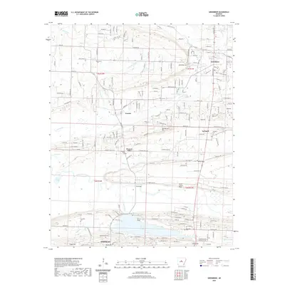
2020 Map of Greenbrier
USGS Topo · Published 2020About this map
Greenbrier and the surrounding Faulkner County countryside are defined by a landscape of prominent ridges and small creek valleys. North of Conway, the terrain transitions from the shoreline of Beaver Fork Lake toward elevated landmarks like Horseshoe Mtn and Pisgah Mtn. This modern survey captures the transition of rural communities like Wooster and Springhill as they navigate the ridges of North Cadron Ridge and Pearson Ridge. Several burial grounds, including Bethlehem Cem and Estep Cem, provide specific points of interest for those tracing family history in the area. The map illustrates a developed road network connecting the smaller settlements to larger hubs, while preserving the identity of local features such as King Bridge and the Frauenthal area. The drainage of East Fork Cadron Creek and its tributaries, including Little Greenbrier Cr and Kaney Cr, continues to shape the geography of these central Arkansas hills.
Find a feature on this map
181 named features on this map. Tap any name to fly to it.
Don’t see what you’re looking for? This feature index may not catch every label — zoom into the map to look around manually.
Map Details
Editions of this 2020 Greenbrier Map
This is the sole edition of this map. No revisions or reprints were ever made.
Other maps of this area

1892 · Morrillton
USGS Topo · 1:125,000

1894 · Morrillton
USGS Topo · 1:125,000

1956 · Russellville
USGS Topo · 1:250,000

1961 · Menifee
USGS Topo · 1:24,000

1961 · Gleason
USGS Topo · 1:24,000

1961 · Conway
USGS Topo · 1:24,000

1961 · Conway
USGS Topo · 1:62,500

1961 · Bee Branch
USGS Topo · 1:62,500

1961 · Greenbrier
USGS Topo · 1:24,000

1961 · Damascus
USGS Topo · 1:24,000