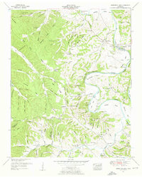
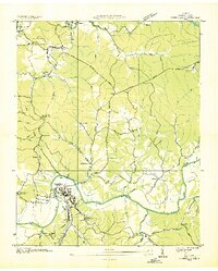
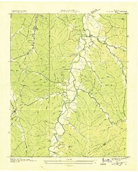
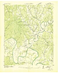
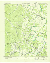
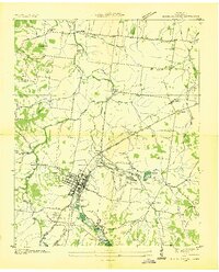
1951 Map of Greenfield Bend
USGS Topo · Published 1957About this map
The Duck River winds through the rural borderlands of Hickman, Maury, and Lewis Counties, carving dramatic limestone curves like Bratton Bend and Greenfield Bend. This mid-century landscape is defined by its deep hollows and high ridges, including Nine Mile Ridge and Saunders Ridge, where small-scale industry and community life persisted. Local commerce is centered around Kettle Mills and the Shady Grove post office, while the presence of strip mines near Kettle Gap points to the extraction of resources from the hills.
Find a feature on this map
143 named features on this map. Tap any name to fly to it.
Don’t see what you’re looking for? This feature index may not catch every label — zoom into the map to look around manually.
Map Details
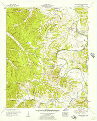
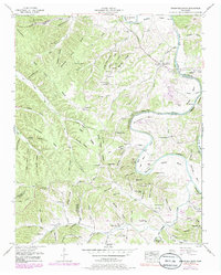
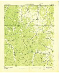
Editions of this 1951 Greenfield Bend Map
3 editions found
Other maps of this area

1901 · Colombia
USGS Topo · 1:125,000

1936 · Williamsport
USGS Topo · 1:24,000

1936 · Primm
USGS Topo · 1:24,000
1936 · Mt Joy
USGS Topo · 1:24,000
1936 · Nunnelly
USGS Topo · 1:24,000
1936 · Sunrise
USGS Topo · 1:24,000
1936 · Littlelot
USGS Topo · 1:24,000
1936 · Greenfield Bend
USGS Topo · 1:24,000
1936 · Mount Pleasant
USGS Topo · 1:24,000
1936 · Gordonsburg
USGS Topo · 1:24,000