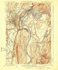
1941 Map of Greenfield
USGS Topo · Published 1941About this map
The Connecticut River serves as the dominant geographic spine of this Franklin County landscape, weaving between the industrial and academic hubs of Greenfield and Deerfield. At this time, the river's power is harnessed by the Rock Dam and Turners Falls Reservoir, supporting the established settlements of Turners Falls and Riverside. To the west, the village of Deerfield is defined by its prestigious educational institutions, including Deerfield Academy and Eagle Brook Sch, while the city of Greenfield shows a dense street grid punctuated by civic sites like the County Hospital.
Find a feature on this map
98 named features on this map. Tap any name to fly to it.
Don’t see what you’re looking for? This feature index may not catch every label — zoom into the map to look around manually.
Map Details
Editions of this 1941 Greenfield Map
3 editions found
Other maps of this area

1885 · Northampton
USGS Topo · 1:62,500

1886 · Northampton
USGS Topo · 1:62,500

1887 · Warwick
USGS Topo · 1:62,500

1887 · Belchertown
USGS Topo · 1:62,500

1889 · Warwick
USGS Topo · 1:62,500

1890 · Belchertown
USGS Topo · 1:62,500

1890 · Greenfield
USGS Topo · 1:62,500

1891 · Northampton
USGS Topo · 1:62,500

1893 · Northampton
USGS Topo · 1:62,500

1893 · Belchertown
USGS Topo · 1:62,500