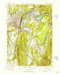
1954 Map of Greenfield
USGS Topo · Published 1956About this map
The Connecticut River carves a deep path through the heart of Franklin County, defining the industrial and social character of this mid-century landscape. At the northern bend, Turners Falls and Riverside flank the Horse River Race, where water power fueled the growth of Montague City. To the west, the village of Greenfield sits at the foot of Rocky Mountain and Poets Seat, showing a dense urban grid that contrasts with the pastoral stretches of East Deerfield.
Find a feature on this map
86 named features on this map. Tap any name to fly to it.
Don’t see what you’re looking for? This feature index may not catch every label — zoom into the map to look around manually.
Map Details
Editions of this 1954 Greenfield Map
2 editions found
Other maps of this area

1885 · Northampton
USGS Topo · 1:62,500

1886 · Northampton
USGS Topo · 1:62,500

1887 · Warwick
USGS Topo · 1:62,500

1887 · Belchertown
USGS Topo · 1:62,500

1889 · Warwick
USGS Topo · 1:62,500

1890 · Belchertown
USGS Topo · 1:62,500

1890 · Greenfield
USGS Topo · 1:62,500

1891 · Northampton
USGS Topo · 1:62,500

1893 · Northampton
USGS Topo · 1:62,500

1893 · Belchertown
USGS Topo · 1:62,500