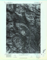
1975 Map of Greenlaw SW
USGS Topo · Published 1981About this map
Machias River winds through the densely forested landscape of the Aroostook wilderness in this mid-1970s orthophotograph. This specialized survey, derived from 1975 aerial photography, provides a literal overhead view of the Maine woods, where the vegetation patterns and logging tracks are as prominent as the topography. The terrain is defined by distinct elevations such as Horse Mountain and Jack Mountain, while The Pinnacle stands as a notable landmark in the southern reaches of the quadrangle. The hydrology of the area is dominated by the South Branch Machias River, which joins the main stem amidst a network of timber-harvesting routes. Unlike standard topographic maps, this imagery captures the actual state of the forest canopy and ground disturbance during a period of active resource management in Northern Maine.
Find a feature on this map
5 named features on this map. Tap any name to fly to it.
Don’t see what you’re looking for? This feature index may not catch every label — zoom into the map to look around manually.
Map Details
Editions of this 1975 Greenlaw SW Map
This is the sole edition of this map. No revisions or reprints were ever made.
Other maps of this area

1930 · Greenlaw
USGS Topo · 1:48,000

1931 · Mooseleuk Lake
USGS Topo · 1:48,000

1933 · Greenlaw
USGS Topo · 1:62,500

1935 · Mooseleuk Lake
USGS Topo · 1:62,500

1954 · Millinocket Lake
USGS Topo · 1:62,500

1954 · Grand Lake Seboeis
USGS Topo · 1:62,500

1954 · Presque Isle
USGS Topo · 1:250,000

1958 · Presque Isle
USGS Topo · 1:250,000

1960 · Presque Isle
USGS Topo · 1:250,000
1963 · Mooseleuk Lake
USGS Topo · 1:62,500