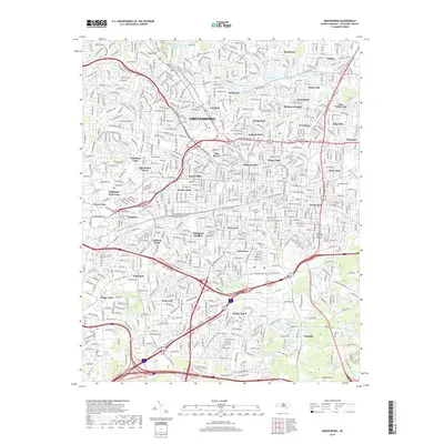
2019 Map of Greensboro
USGS Topo · Published 2019About this map
The textile industrial heritage of Greensboro is etched into the landscape of this 2019 survey, where neighborhoods like Revolution, Proximity, and White Oak recall the mill villages that once anchored the local economy. The legacy of these manufacturing centers is further evidenced by the Revolution Mill Reservoir and White Oak Lake, while the Atlantic and Yadkin Railway corridor traces the historic path of commerce through the city. Residential expansion is visible in established districts such as Hamilton Lakes, Irving Park, and Starmount Forest, which contrast with the denser urban grids of McAdoo Heights and Nocho Park. Natural drainage follows the paths of N Buffalo Cr and S Buffalo Cr, which wind through the city's green spaces including Latham Park and Lindley Park. For researchers, the map provides precise locations for local landmarks like Cone Cem and early settlements such as Terra Cotta and Pomona.
Find a feature on this map
70 named features on this map. Tap any name to fly to it.
Don’t see what you’re looking for? This feature index may not catch every label — zoom into the map to look around manually.
Map Details
Editions of this 2019 Greensboro Map
This is the sole edition of this map. No revisions or reprints were ever made.
Other maps of this area

1950 · High Point East
USGS Topo · 1:24,000

1951 · High Point East
USGS Topo · 1:24,000

1951 · Guilford
USGS Topo · 1:24,000

1951 · Lake Brandt
USGS Topo · 1:24,000

1951 · Browns Summit
USGS Topo · 1:24,000

1951 · Greensboro
USGS Topo · 1:24,000

1952 · Mc Leansville
USGS Topo · 1:24,000

1953 · Raleigh
USGS Topo · 1:250,000

1953 · Greensboro
USGS Topo · 1:250,000

1954 · Greensboro
USGS Topo · 1:250,000