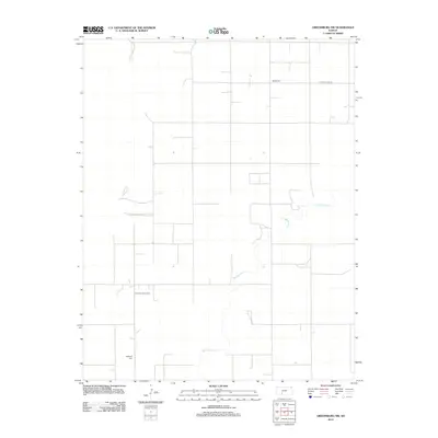
2012 Map of Greensburg NW
USGS Topo · Published 2012About this map
Rattlesnake Cr meanders through this portion of the Kansas plains, tracing a wandering path across a landscape defined by the rigid section lines of the Public Land Survey System. The area maintains its rural character in the early 21st century, with large agricultural tracts occasionally punctuated by indicators of the region's underlying resources, such as the Fralick South Oil Field. This survey provides valuable coordinates for genealogists and local historians, pinpointing the locations of Bethel Cem in the north and McKinley Cem to the south. These small cemeteries, along with the thoroughfare of Kiowa Co Line Rd, serve as fixed landmarks in a vast prairie environment where natural watercourses and man-made boundaries are the primary features.
Find a feature on this map
5 named features on this map. Tap any name to fly to it.
Don’t see what you’re looking for? This feature index may not catch every label — zoom into the map to look around manually.
Map Details
Editions of this 2012 Greensburg NW Map
This is the sole edition of this map. No revisions or reprints were ever made.
Other maps of this area

1889 · Kinsley
USGS Topo · 1:125,000

1892 · Kinsley
USGS Topo · 1:125,000

1892 · Spearville
USGS Topo · 1:125,000

1894 · Spearville
USGS Topo · 1:125,000

1894 · Kinsley
USGS Topo · 1:125,000

1955 · Pratt
USGS Topo · 1:250,000

1959 · Pratt
USGS Topo · 1:250,000

1969 · Bucklin NE
USGS Topo · 1:24,000

1969 · Bucklin SE
USGS Topo · 1:24,000

1969 · Greensburg NW
USGS Topo · 1:24,000