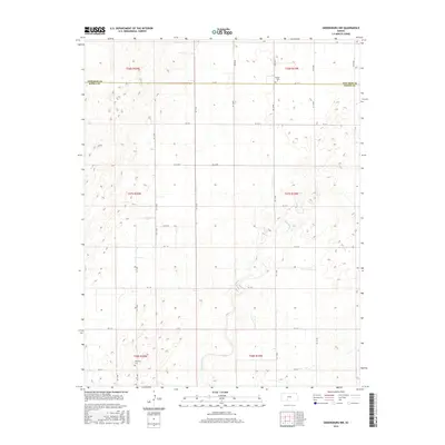
2015 Map of Greensburg NW
USGS Topo · Published 2015About this map
Rattlesnake Cr winds through the expansive prairie of south-central Kansas, cutting across the border of Edwards Co and Kiowa Co. This landscape is defined by the Public Land Survey System, where a rigid grid of rural roads like 80th Ave and KC A St organizes the agricultural homesteads. The map serves as a vital record for family researchers, identifying two distinct burial sites that anchor the local community: Bethel Cem in the north and McKinley Cem to the south. The terrain is characterized by subtle elevation changes and numerous depressions typical of the region's drainage patterns, illustrating how early settlers navigated the open plains before modern development. The strictly rectilinear road network highlights the intersection of late 19th-century land planning with the natural, meandering path of the creek.
Find a feature on this map
31 named features on this map. Tap any name to fly to it.
Don’t see what you’re looking for? This feature index may not catch every label — zoom into the map to look around manually.
Map Details
Editions of this 2015 Greensburg NW Map
This is the sole edition of this map. No revisions or reprints were ever made.
Other maps of this area

1889 · Kinsley
USGS Topo · 1:125,000

1892 · Kinsley
USGS Topo · 1:125,000

1892 · Spearville
USGS Topo · 1:125,000

1894 · Spearville
USGS Topo · 1:125,000

1894 · Kinsley
USGS Topo · 1:125,000

1955 · Pratt
USGS Topo · 1:250,000

1959 · Pratt
USGS Topo · 1:250,000

1969 · Bucklin NE
USGS Topo · 1:24,000

1969 · Bucklin SE
USGS Topo · 1:24,000

1969 · Greensburg NW
USGS Topo · 1:24,000