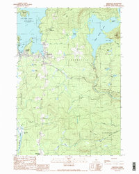
1989 Map of Greenville
USGS Topo · Published 1989About this map
Greenville serves as the focal point of this late-twentieth-century study of the southern tip of Moosehead Lake. The landscape transition from the developed waterfront at Greenville Junction to the timbered heights of Rum Mountain and Scammon Ridge reflects the region's dual identity as a transportation hub and a gateway to the Maine woods. The map tracks the complex hydrology of the area, including the flow of Wilson Stream and the Piscataquis River, alongside cultural markers like the Greenville Municipal Airport and the local Cemetary. Residential clusters such as The Highlands and Harfords Point illustrate the concentrated settlement patterns around the lake's coves, while more distant points like Upper Shirley Corner and East Shirley Bog mark the shift into the sparsely populated townships of Shirley and Elliottsville.
Find a feature on this map
50 named features on this map. Tap any name to fly to it.
Don’t see what you’re looking for? This feature index may not catch every label — zoom into the map to look around manually.
Map Details
Editions of this 1989 Greenville Map
2 editions found
Other maps of this area

1920 · Moosehead Lake
USGS Topo · 1:62,500

1922 · Moosehead Lake
USGS Topo · 1:62,500

1930 · Moosehead Lake
USGS Topo · 1:62,500

1944 · Moosehead Lake
USGS Topo · 1:62,500

1950 · Sebec Lake
USGS Topo · 1:62,500

1951 · Greenville
USGS Topo · 1:62,500

1952 · First Roach Pond
USGS Topo · 1:62,500

1954 · Millinocket
USGS Topo · 1:250,000

1957 · Moosehead Lake
USGS Topo · 1:62,500

1958 · Millinocket
USGS Topo · 1:250,000
Featured Places
- Greenville, ME
- Shirley, ME
- Harfords Point Township, ME
- Moosehead Junction Township, ME
- Elliottsville Township, ME