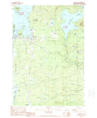
1989 Map of Greenville
USGS Topo · Published 1989About this map
Greenville serves as the focal point for this late-century survey of the southern shore of Moosehead Lake, where the community's connection to the northern Maine woods is evident in the transition from town streets to the waters of West Cove. The landscape is defined by its complex hydrology, with the Piscataquis River originating in the south while numerous smaller bodies like Sawyer Pond and Salmon Pond are tucked into the high ground. The layout of Greenville Junction and the presence of the Greenville Municipal Airport reflect the area's role as a regional transportation hub for forestry and recreation. To the east, the terrain rises toward Rum Mountain, while the southern reaches near Upper Shirley Corner and East Shirley Bog show a more subdued, marshy topography. This era of mapping documents the established boundaries of Elliottsville Plt and Shirley, capturing the footprint of these timber-country outposts before further modern development.
Find a feature on this map
47 named features on this map. Tap any name to fly to it.
Don’t see what you’re looking for? This feature index may not catch every label — zoom into the map to look around manually.
Map Details
Editions of this 1989 Greenville Map
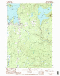
2 editions found
Other maps of this area

1920 · Moosehead Lake
USGS Topo · 1:62,500

1922 · Moosehead Lake
USGS Topo · 1:62,500

1930 · Moosehead Lake
USGS Topo · 1:62,500

1944 · Moosehead Lake
USGS Topo · 1:62,500

1950 · Sebec Lake
USGS Topo · 1:62,500

1951 · Greenville
USGS Topo · 1:62,500

1952 · First Roach Pond
USGS Topo · 1:62,500

1954 · Millinocket
USGS Topo · 1:250,000

1957 · Moosehead Lake
USGS Topo · 1:62,500

1958 · Millinocket
USGS Topo · 1:250,000
Featured Places
- Greenville, ME
- Shirley, ME
- Harfords Point Township, ME
- Moosehead Junction Township, ME
- Elliottsville Township, ME