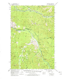
1956 Map of Greenwater
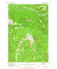
USGS Topo · Published 1982About this map
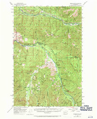
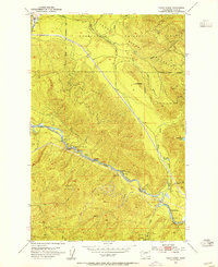
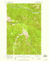
Northern Pacific rail lines trace the northern valley of the Green River, connecting a series of small riverside settlements including Humphrey, Maywood, and Nagrom. This mid-century survey captures the industrial and recreational character of the Snoqualmie National Forest area, where the convergence of the White River and the Greenwater River at Greenwater anchors a network of fire lookouts and forest service outposts. The presence of the Boundary Guard Sta and Twin Creeks Guard Sta highlights the active management of these timberlands.
Find a feature on this map
82 named features on this map. Tap any name to fly to it.
Don’t see what you’re looking for? This feature index may not catch every label — zoom into the map to look around manually.
Map Details
Editions of this 1956 Greenwater Map
4 editions found
Other maps of this area

1901 · Snoqualmie Pass
USGS Topo · 1:125,000

1902 · Mount Aix
USGS Topo · 1:125,000

1903 · Snoqualmie
USGS Topo · 1:125,000

1904 · Mt Aix
USGS Topo · 1:125,000

1913 · Cedar Lake
USGS Topo · 1:125,000

1924 · Mt Rainier
USGS Topo · 1:96,000

1928 · Mt Rainier
USGS Topo · 1:125,000

1950 · Yakima
USGS Topo · 1:250,000
1953 · Eagle Gorge
USGS Topo · 1:24,000
1956 · Greenwater
USGS Topo · 1:62,500