
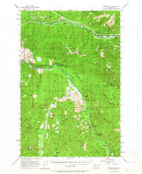
1956 Map of Greenwater
USGS Topo · Published 1958About this map
The Northern Pacific railroad corridor anchors the northern reaches of this landscape, connecting isolated settlements like Humphrey, Maywood, and Nagrom along the Green River. This mid-century survey illustrates the industrial and recreational footprint within the Snoqualmie National Forest, where timber management and mountain access defined the local economy. Further south, the confluence of the White River and Greenwater River marks a transition toward the high peaks, where landmarks such as The Palisades and Huckleberry Mountain dominate the horizon.
Find a feature on this map
81 named features on this map. Tap any name to fly to it.
Don’t see what you’re looking for? This feature index may not catch every label — zoom into the map to look around manually.
Map Details
Editions of this 1956 Greenwater Map
4 editions found
Other maps of this area

1901 · Snoqualmie Pass
USGS Topo · 1:125,000

1902 · Mount Aix
USGS Topo · 1:125,000

1903 · Snoqualmie
USGS Topo · 1:125,000

1904 · Mt Aix
USGS Topo · 1:125,000

1913 · Cedar Lake
USGS Topo · 1:125,000

1924 · Mt Rainier
USGS Topo · 1:96,000

1928 · Mt Rainier
USGS Topo · 1:125,000

1950 · Yakima
USGS Topo · 1:250,000

1953 · Eagle Gorge
USGS Topo · 1:24,000

1956 · Enumclaw
USGS Topo · 1:62,500