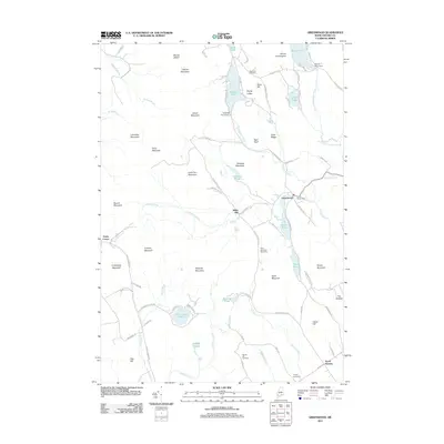
2011 Map of Greenwood
USGS Topo · Published 2011About this map
Greenwood and the surrounding Oxford County highlands are captured here in a period of quiet rural character. The landscape is defined by its numerous water bodies, including Twitchell Pond, South Pond, and Hutchinson Pond, many of which are regulated by infrastructure such as the Bryant Pond Dam and Hicks Pond Dam. The rugged terrain of the Oxford Hills is marked by significant peaks like Mount Abram, Mount Christopher, and Peabody Mountain, while local industry and history are evident at the Willis Mill site.
Find a feature on this map
92 named features on this map. Tap any name to fly to it.
Don’t see what you’re looking for? This feature index may not catch every label — zoom into the map to look around manually.
Map Details
Editions of this 2011 Greenwood Map
This is the sole edition of this map. No revisions or reprints were ever made.
Other maps of this area

1896 · Norway
USGS Topo · 1:62,500

1909 · Fryeburg
USGS Topo · 1:62,500

1911 · Fryeburg
USGS Topo · 1:62,500

1911 · Bryant Pond
USGS Topo · 1:62,500

1914 · Bethel
USGS Topo · 1:62,500

1914 · Bryant Pond
USGS Topo · 1:62,500

1940 · Bethel
USGS Topo · 1:62,500

1941 · Bethel
USGS Topo · 1:62,500

1941 · Fryeburg
USGS Topo · 1:62,500

1942 · Bryant Pond
USGS Topo · 1:62,500