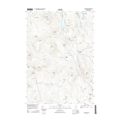
2014 Map of Greenwood
USGS Topo · Published 2014About this map
Greenwood and the nearby settlement of Willis Mill sit at the center of this 2014 survey of Oxford County. The landscape is defined by a dense network of water bodies, including Twitchell Pond, Indian Pond, and South Pond, which connect via the Little Androscoggin River and various mountain brooks. This modern record preserves the exact locations of several small family and community burial grounds, such as Ames Cem, Merrill Hill Cem, and Rowe Hill Cem, providing essential data for local historians. High points like Mount Abram and Patch Mountain overlook a region where contemporary residential developments, evidenced by streets like Alpine Shores Rd, meet long-established hamlets like North Norway and Hunts Corner.
Find a feature on this map
110 named features on this map. Tap any name to fly to it.
Don’t see what you’re looking for? This feature index may not catch every label — zoom into the map to look around manually.
Map Details
Editions of this 2014 Greenwood Map
This is the sole edition of this map. No revisions or reprints were ever made.
Other maps of this area

1896 · Norway
USGS Topo · 1:62,500

1909 · Fryeburg
USGS Topo · 1:62,500

1911 · Fryeburg
USGS Topo · 1:62,500

1911 · Bryant Pond
USGS Topo · 1:62,500

1914 · Bethel
USGS Topo · 1:62,500

1914 · Bryant Pond
USGS Topo · 1:62,500

1940 · Bethel
USGS Topo · 1:62,500

1941 · Bethel
USGS Topo · 1:62,500

1941 · Fryeburg
USGS Topo · 1:62,500

1942 · Bryant Pond
USGS Topo · 1:62,500