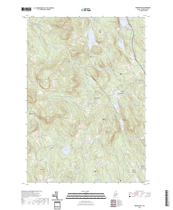
2024 Map of Greenwood
USGS Topo · Published 2024About this map
Willis Mill stands along the Sanborn River, reflecting the traditional water-driven industry that shaped this area of Oxford County. The landscape is defined by its numerous summits, including Mt Abram, Peabody Mtn, and Patch Mtn, which frame a complex network of glacial ponds and narrow valleys. Small settlements like Greenwood and Hunts Corner remain connected by historic routes such as Patch Mountain Rd and Irish Neighborhood Rd.
Find a feature on this map
106 named features on this map. Tap any name to fly to it.
Don’t see what you’re looking for? This feature index may not catch every label — zoom into the map to look around manually.
Map Details
Editions of this 2024 Greenwood Map
This is the sole edition of this map. No revisions or reprints were ever made.
Other maps of this area

1896 · Norway
USGS Topo · 1:62,500

1909 · Fryeburg
USGS Topo · 1:62,500

1911 · Fryeburg
USGS Topo · 1:62,500

1911 · Bryant Pond
USGS Topo · 1:62,500

1914 · Bethel
USGS Topo · 1:62,500

1914 · Bryant Pond
USGS Topo · 1:62,500

1940 · Bethel
USGS Topo · 1:62,500

1941 · Bethel
USGS Topo · 1:62,500

1941 · Fryeburg
USGS Topo · 1:62,500

1942 · Bryant Pond
USGS Topo · 1:62,500