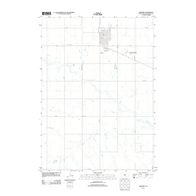
2012 Map of Gregory
USGS Topo · Published 2012About this map
Gregory stands as a clear center of commerce and community in this South Dakota landscape, defined by a distinct grid of streets like Main St and Logan Ave. To the west of the town center, the Hilltop Drive-In reflects local mid-century recreational history, while the Gregory Municipal Airport, Flynn Field borders the eastern edge of the settlement.
Find a feature on this map
26 named features on this map. Tap any name to fly to it.
Don’t see what you’re looking for? This feature index may not catch every label — zoom into the map to look around manually.
Map Details
Editions of this 2012 Gregory Map
This is the sole edition of this map. No revisions or reprints were ever made.
Other maps of this area

1955 · Mitchell
USGS Topo · 1:250,000

1959 · Mitchell
USGS Topo · 1:250,000

1964 · Gregory SE
USGS Topo · 1:24,000

1964 · Gregory
USGS Topo · 1:24,000

1964 · Dallas
USGS Topo · 1:24,000

1964 · Paxton
USGS Topo · 1:24,000
1964 · Carlock
USGS Topo · 1:24,000
1964 · Burke
USGS Topo · 1:24,000

1971 · Dixon SW
USGS Topo · 1:24,000

1971 · Colome SE
USGS Topo · 1:24,000