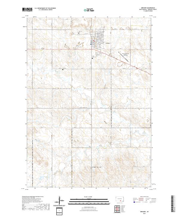
2021 Map of Gregory
USGS Topo · Published 2021About this map
Gregory functions as the central hub of this South Dakota landscape, characterized by a structured grid of residential streets and localized industry. The town is flanked by significant local landmarks including the Gregory Municipal Airport - Flynn Field to the east and a series of burial grounds that reflect the community's heritage, such as Saint Joseph Cem, IOOF Cem, and the ZCBJ Cem. Beyond the city limits, the terrain is defined by the winding paths of Ponca Cr and Masdon Cr, which cut through the agricultural sections of Township 97 North, Range 73 West. The network of section-line roads, including the Gregory Township Hwy, illustrates the systematic land division of the Great Plains, connecting remote farmsteads to the commercial center of the county.
Find a feature on this map
60 named features on this map. Tap any name to fly to it.
Don’t see what you’re looking for? This feature index may not catch every label — zoom into the map to look around manually.
Map Details
Editions of this 2021 Gregory Map
This is the sole edition of this map. No revisions or reprints were ever made.
Other maps of this area

1955 · Mitchell
USGS Topo · 1:250,000

1959 · Mitchell
USGS Topo · 1:250,000

1964 · Gregory SE
USGS Topo · 1:24,000

1964 · Gregory
USGS Topo · 1:24,000

1964 · Dallas
USGS Topo · 1:24,000

1964 · Paxton
USGS Topo · 1:24,000
1964 · Carlock
USGS Topo · 1:24,000
1964 · Burke
USGS Topo · 1:24,000

1971 · Dixon SW
USGS Topo · 1:24,000

1971 · Colome SE
USGS Topo · 1:24,000