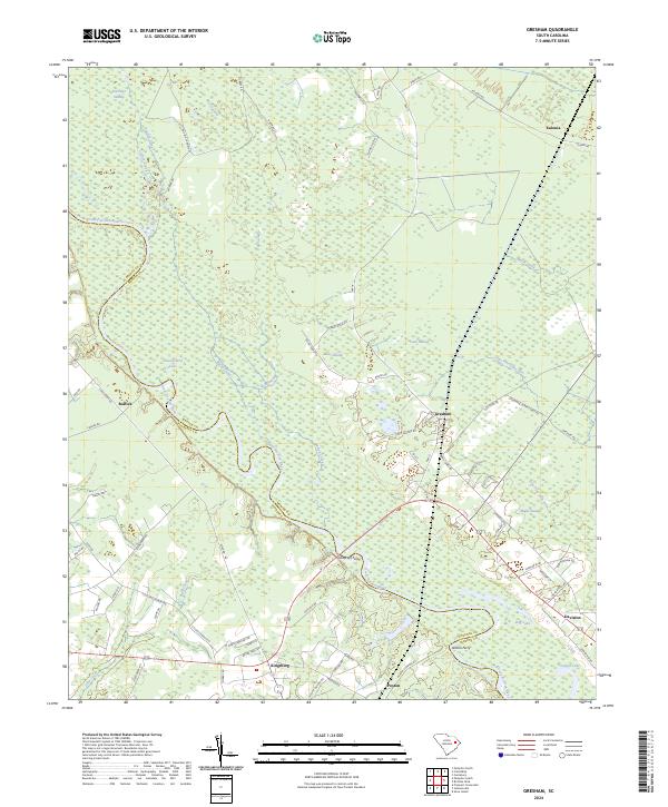
2024 Map of Gresham
USGS Topo · Published 2024About this map
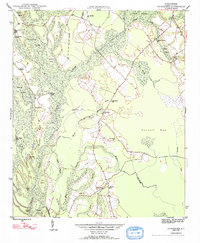
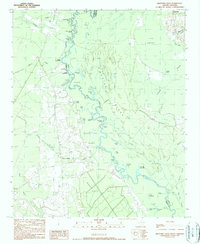
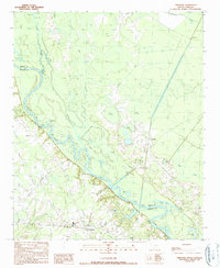
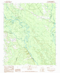
The Great Pee Dee River meanders through this landscape, defining the winding boundary between Florence and Marion counties. This riparian environment is characterized by extensive wetlands, including Bear Swamp, Cane Swamp, and Maple Swamp, alongside isolated water bodies like Shackleford Lake and Dog Lake. The settlement pattern follows the higher ground away from the floodplains, anchored by small communities such as Gresham and Kingsburg. Historical river crossings are evidenced by Godfreys Ferry and Allison Ferry, points that once served as vital links across the river. The local road network, featuring routes like Old Tram Rd and St Mark Cemetery Rd, reflects the area's transition from traditional river-and-rail dependencies to modern connectivity while maintaining its rural, water-defined character.
Find a feature on this map
77 named features on this map. Tap any name to fly to it.
Don’t see what you’re looking for? This feature index may not catch every label — zoom into the map to look around manually.
Map Details
Editions of this 2024 Gresham Map
This is the sole edition of this map. No revisions or reprints were ever made.
Historical Maps of Kingsburg Through Time
8 maps found