
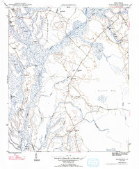
1947 Map of Friendship
USGS Topo · Published 1947About this map
Catfish Creek and its complex network of tributaries define this part of Marion County, where the Lowcountry landscape is a dense arrangement of swamps and isolated ridges. The settlement of Friendship serves as a small inland hub, surrounded by a rural infrastructure of family and community landmarks. Genealogists will find significant value in the numerous burial sites across the landscape, including Wahee Cem, Kirton Cem, and Tabernacle Cem.
Find a feature on this map
38 named features on this map. Tap any name to fly to it.
Don’t see what you’re looking for? This feature index may not catch every label — zoom into the map to look around manually.
Map Details
Editions of this 1947 Friendship Map
2 editions found
Other maps of this area

1940 · Florence East
USGS Topo · 1:62,500

1945 · Florence East
USGS Topo · 1:62,500

1946 · Hyman
USGS Topo · 1:62,500

1946 · Johnsonville
USGS Topo · 1:62,500

1946 · Mullins
USGS Topo · 1:24,000

1947 · Marion
USGS Topo · 1:24,000

1947 · Centenary
USGS Topo · 1:24,000

1947 · Mullins
USGS Topo · 1:24,000

1949 · Georgetown
USGS Topo · 1:250,000

1953 · Florence
USGS Topo · 1:250,000