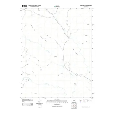
2010 Map of Gribble Mountain
USGS Topo · Published 2010About this map
Venture Number One Mine and Isabel Mine sit nestled among the high gulches of Fremont County, illustrating the enduring legacy of resource extraction in this part of Colorado. The landscape is defined by its drainage systems, including the waters of Currant Creek, Cottonwood Creek, and Tallahassee Creek, which carve through prominent elevations like Gribble Mountain and Crampton Mountain. Along the eastern edges, the Lucky Strike Mine stands near Twelvemile Park, while the south is marked by the presence of the Harvey Brothers Dam. The area's topography is a complex network of named ravines, such as Seymour Gulch and Binckley Gulch, connected by unpaved routes like Sand Gulch Rd and Preachers Gulch Rd. This map captures a rugged interior where prospecting and ranching infrastructure coexist with natural landmarks like Table Mountain and Gardner Peak.
Find a feature on this map
41 named features on this map. Tap any name to fly to it.
Don’t see what you’re looking for? This feature index may not catch every label — zoom into the map to look around manually.
Map Details
Editions of this 2010 Gribble Mountain Map
This is the sole edition of this map. No revisions or reprints were ever made.
Other maps of this area

1889 · Canon City
USGS Topo · 1:125,000

1892 · Canon City
USGS Topo · 1:125,000

1894 · Pikes Peak
USGS Topo · 1:125,000

1901 · Pikes Peak
USGS Topo · 1:125,000

1942 · Cover Mtn.
USGS Topo · 1:62,500

1948 · Cover Mtn.
USGS Topo · 1:62,500

1954 · Pueblo
USGS Topo · 1:250,000

1957 · Pueblo
USGS Topo · 1:250,000

1958 · Pueblo
USGS Topo · 1:250,000

1959 · Black Mountain
USGS Topo · 1:62,500