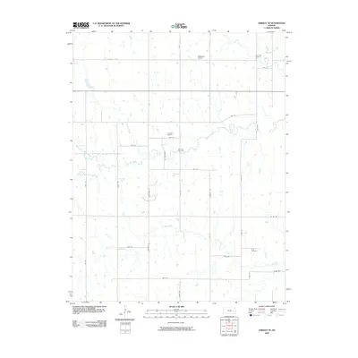
2009 Map of Gridley SE
USGS Topo · Published 2009About this map
Small creek valleys and agricultural sections define this pocket of Coffey County during the first decade of the 2000s. Several ancestral burial grounds are distributed across the landscape, including Fairhope Cemetery, Elk Creek Cemetery, Big Creek Cemetery, and Siria Cemetery, which provide vital touchstones for family historians. The terrain is drained by a network of waterways such as South Big Creek, Dinner Creek, and Duck Creek, which flow through a grid of rural roads. While largely agrarian, the presence of McMullen Airport in the northern reaches indicates modern utility. The road network, including arterial routes like Homestead Rd and Indian Rd, reflects the enduring township-and-range surveying system that has governed this region's development since early settlement.
Find a feature on this map
35 named features on this map. Tap any name to fly to it.
Don’t see what you’re looking for? This feature index may not catch every label — zoom into the map to look around manually.
Map Details
Editions of this 2009 Gridley SE Map
This is the sole edition of this map. No revisions or reprints were ever made.
Other maps of this area

1885 · Burlington
USGS Topo · 1:125,000

1886 · Fredonia
USGS Topo · 1:125,000

1894 · Fredonia
USGS Topo · 1:125,000

1894 · Burlington
USGS Topo · 1:125,000

1947 · Lawrence
USGS Topo · 1:250,000

1947 · Joplin
USGS Topo · 1:250,000

1949 · Joplin
USGS Topo · 1:250,000

1950 · Lawrence
USGS Topo · 1:250,000

1954 · Joplin
USGS Topo · 1:250,000

1956 · Lawrence
USGS Topo · 1:250,000