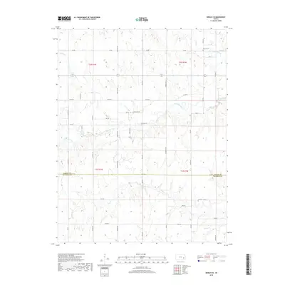
2018 Map of Gridley SE
USGS Topo · Published 2018About this map
The Coffey and Woodson county line divides this prairie landscape, where the agricultural grid is defined by a dense network of local roads including Homestead Rd, Kafir Rd, and Indian Rd. Several historic burial sites, including Big Creek Cem, Fairhope Cem, and Elk Creek Cem, are preserved within the sections, providing essential points of reference for genealogists tracking local families. The drainage pattern is defined by several seasonal waterways such as Varvel Cr, South Big Creek, and Duck Cr which wander across the sections of T22S and T23S. This 2018 survey illustrates a modern rural layout that remains deeply anchored to the original Public Land Survey System, with roads often following section lines established over a century ago.
Find a feature on this map
47 named features on this map. Tap any name to fly to it.
Don’t see what you’re looking for? This feature index may not catch every label — zoom into the map to look around manually.
Map Details
Editions of this 2018 Gridley SE Map
This is the sole edition of this map. No revisions or reprints were ever made.
Other maps of this area

1885 · Burlington
USGS Topo · 1:125,000

1886 · Fredonia
USGS Topo · 1:125,000

1894 · Fredonia
USGS Topo · 1:125,000

1894 · Burlington
USGS Topo · 1:125,000

1947 · Lawrence
USGS Topo · 1:250,000

1947 · Joplin
USGS Topo · 1:250,000

1949 · Joplin
USGS Topo · 1:250,000

1950 · Lawrence
USGS Topo · 1:250,000

1954 · Joplin
USGS Topo · 1:250,000

1956 · Lawrence
USGS Topo · 1:250,000