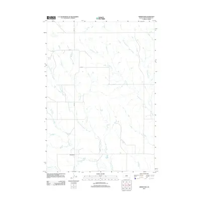
2012 Map of Grindstone
USGS Topo · Published 2012About this map
Grindstone serves as the primary focal point of this Haakon County landscape, situated where the high plains meet a complex network of prairie drainage. The area's character is defined by the winding course of the N Fork Bad River and its various tributaries, which have carved a distinctive pattern into the South Dakota terrain. Local hydrology is particularly notable for its uniquely named watercourses, including Dirty Womans Cr, Poeno Cr, and the branching arms of Deadmans Cr. These names provide a window into the regional vernacular and the history of settlement in this part of the state. The section-line road system, including 206th Ave and 220th St, dictates the movement across the quadrangle, connecting the scattered ranching interests that define this quiet corner of the Great Plains during the early twenty-first century.
Find a feature on this map
10 named features on this map. Tap any name to fly to it.
Don’t see what you’re looking for? This feature index may not catch every label — zoom into the map to look around manually.
Map Details
Editions of this 2012 Grindstone Map
This is the sole edition of this map. No revisions or reprints were ever made.
Other maps of this area

1953 · Rapid City
USGS Topo · 1:250,000

1954 · Pierre
USGS Topo · 1:250,000

1955 · Pedro SE
USGS Topo · 1:24,000

1957 · Rapid City
USGS Topo · 1:250,000

1958 · Pierre
USGS Topo · 1:250,000

1983 · Post Ranch
USGS Topo · 1:24,000

1983 · Philip
USGS Topo · 1:100,000

1983 · Hilland
USGS Topo · 1:24,000
1983 · Grindstone
USGS Topo · 1:24,000
1983 · Horse Tooth
USGS Topo · 1:24,000