
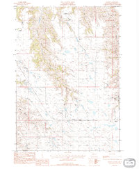
1983 Map of Post Ranch
USGS Topo · Published 1984About this map
Dowling Community Ch serves as a central landmark in this portion of Haakon County, situated near the headwaters of the Middle Fork South Ash Creek. The landscape is defined by the drainage basins of Ash Creek and Bridger Creek, where isolated ranching outposts like Foley Ranch, Gabriel Ranch, and the eponymous Post Ranch manage the expansive prairie. This 1983 provisional survey reflects a period when rural community life was anchored by local churches and family-run ranching operations. The mapping detail emphasizes the remote water-management patterns of the region, tracing the intermittent flows that carve through the South Dakota plains, providing essential resources for the dispersed homesteads and community centers shown across the quadrangle.
Find a feature on this map
11 named features on this map. Tap any name to fly to it.
Don’t see what you’re looking for? This feature index may not catch every label — zoom into the map to look around manually.
Map Details
Editions of this 1983 Post Ranch Map
This is the sole edition of this map. No revisions or reprints were ever made.
Other maps of this area

1953 · Rapid City
USGS Topo · 1:250,000

1954 · Pierre
USGS Topo · 1:250,000

1955 · Pedro
USGS Topo · 1:24,000

1955 · Pedro SE
USGS Topo · 1:24,000

1955 · Hilland NW
USGS Topo · 1:24,000

1957 · Rapid City
USGS Topo · 1:250,000

1958 · Pierre
USGS Topo · 1:250,000

1983 · Philip
USGS Topo · 1:100,000

1983 · Hilland
USGS Topo · 1:24,000
1983 · Hartley
USGS Topo · 1:24,000