
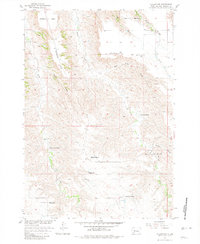
1955 Map of Hilland NW
USGS Topo · Published 1957About this map
Scattered ranchsteads and rural schools define the mid-century landscape of this Haakon County region, mapped during the mid-1950s as part of the Missouri River Basin development program. The topography is characterized by a series of long, name-bearing drainage draws such as Elm Tree Draw and Dunn Draw, which cut through high plateau features like Barthold Flat and Carnahan Flat. The settlement pattern reflects the vastness of South Dakota's western plains, where social life centered on isolated ranch hubs like Blair Ranch and Peterson Ranch.
Find a feature on this map
22 named features on this map. Tap any name to fly to it.
Don’t see what you’re looking for? This feature index may not catch every label — zoom into the map to look around manually.
Map Details
Editions of this 1955 Hilland NW Map
2 editions found
Other maps of this area

1953 · Rapid City
USGS Topo · 1:250,000

1954 · Pierre
USGS Topo · 1:250,000

1955 · Bridger
USGS Topo · 1:24,000

1955 · Pedro
USGS Topo · 1:24,000

1955 · Bridger SE
USGS Topo · 1:24,000

1955 · Howes
USGS Topo · 1:24,000

1955 · Pedro SE
USGS Topo · 1:24,000

1957 · Rapid City
USGS Topo · 1:250,000

1958 · Pierre
USGS Topo · 1:250,000

1983 · Post Ranch
USGS Topo · 1:24,000