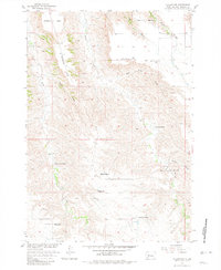
1955 Map of Hilland NW
USGS Topo · Published 1981About this map
Haxby and a network of family ranches define this landscape in the western reaches of the Missouri River Basin. The 1955 survey reveals a pattern of dispersed settlement, where ranching operations such as the Charles Price Ranch, Hanson Ranch, and Blair Ranch are anchored by vital water sources like Indian Springs and Bridger Creek. The numerous draws, including Elm Tree Draw and Dunn Draw, illustrate the complex drainage system feeding into the larger creek networks.
Find a feature on this map
26 named features on this map. Tap any name to fly to it.
Don’t see what you’re looking for? This feature index may not catch every label — zoom into the map to look around manually.
Map Details
Editions of this 1955 Hilland NW Map
2 editions found
Other maps of this area

1953 · Rapid City
USGS Topo · 1:250,000

1954 · Pierre
USGS Topo · 1:250,000

1955 · Bridger
USGS Topo · 1:24,000

1955 · Pedro
USGS Topo · 1:24,000

1955 · Bridger SE
USGS Topo · 1:24,000

1955 · Howes
USGS Topo · 1:24,000

1955 · Pedro SE
USGS Topo · 1:24,000

1955 · Hilland NW
USGS Topo · 1:24,000

1957 · Rapid City
USGS Topo · 1:250,000

1958 · Pierre
USGS Topo · 1:250,000