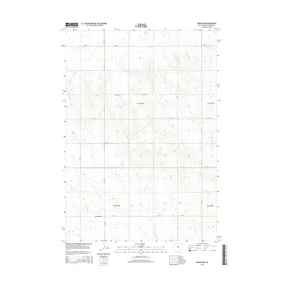
2015 Map of Grindstone
USGS Topo · Published 2015About this map
Grindstone and its surrounding drainage networks define this section of the western South Dakota plains. The settlement is positioned near the N Fork Bad River, a critical water source in a landscape otherwise dominated by intricate intermittent creek systems. Notable among these are the northern and western forks of Deadmans Cr and the descriptively named Dirty Womans Cr, which carve through the terrain as they move toward larger basins.
Find a feature on this map
22 named features on this map. Tap any name to fly to it.
Don’t see what you’re looking for? This feature index may not catch every label — zoom into the map to look around manually.
Map Details
Editions of this 2015 Grindstone Map
This is the sole edition of this map. No revisions or reprints were ever made.
Other maps of this area

1953 · Rapid City
USGS Topo · 1:250,000

1954 · Pierre
USGS Topo · 1:250,000

1955 · Pedro SE
USGS Topo · 1:24,000

1957 · Rapid City
USGS Topo · 1:250,000

1958 · Pierre
USGS Topo · 1:250,000

1983 · Post Ranch
USGS Topo · 1:24,000

1983 · Philip
USGS Topo · 1:100,000

1983 · Hilland
USGS Topo · 1:24,000
1983 · Grindstone
USGS Topo · 1:24,000
1983 · Horse Tooth
USGS Topo · 1:24,000