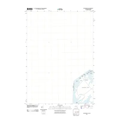
2011 Map of Grindstone Island
USGS Topo · Published 2011About this map
Grindstone Island sits along the international boundary between Canada and the United States, anchored by the small settlement of Grindstone. This portion of the Thousand Islands region is characterized by a network of inlets and smaller landmasses, including Potter Island, Chub Island, and Watch Island. The island’s interior is navigated by a simple road system including Middle Rd and Head Island Rd, which connect the scattered residential points to local landmarks like Thurso Cemetery near the shores of Thurso Bay. This modern survey highlights the maritime geography of the area, detailing numerous coastal features such as Webster Point, McRay Point, and several surrounding islets like Peach Island and Flat Huckleberry Island. The map provides a clear view of the bay system, tracing the contours of Buck Bay and Flynn Bay on the southern reaches of the island.
Find a feature on this map
19 named features on this map. Tap any name to fly to it.
Don’t see what you’re looking for? This feature index may not catch every label — zoom into the map to look around manually.
Map Details
Editions of this 2011 Grindstone Island Map
This is the sole edition of this map. No revisions or reprints were ever made.
Other maps of this area

1895 · Cape Vincent
USGS Topo · 1:62,500

1900 · Clayton
USGS Topo · 1:62,500

1903 · Grindstone
USGS Topo · 1:62,500

1903 · Clayton
USGS Topo · 1:62,500

1942 · Cape Vincent North
USGS Topo · 1:31,680

1942 · Sawmill Bay
USGS Topo · 1:31,680

1942 · Clayton
USGS Topo · 1:24,000

1943 · Thousand Island Park
USGS Topo · 1:31,680

1943 · Clayton
USGS Topo · 1:31,680
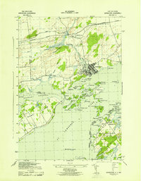
1943 · Grindstone
USGS Topo · 1:31,680