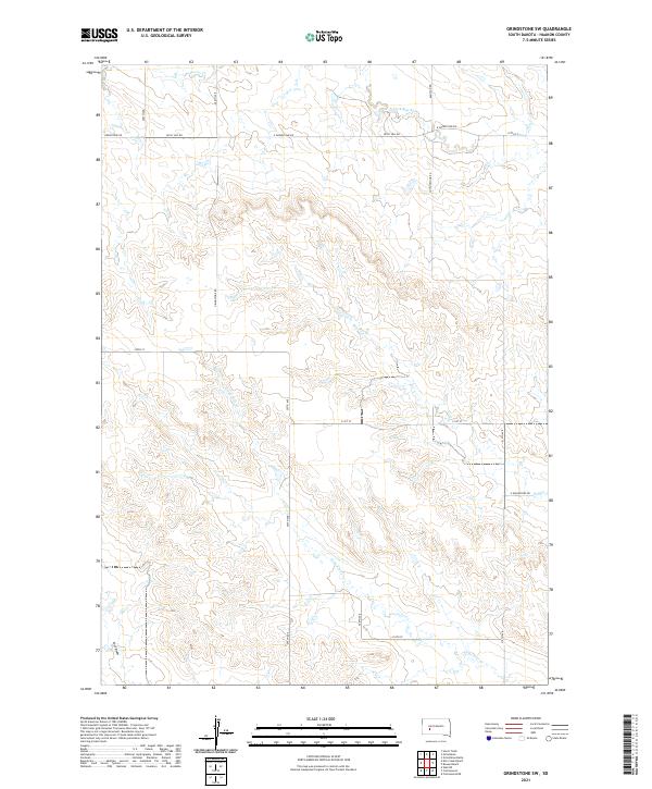
2021 Map of Grindstone SW
USGS Topo · Published 2021About this map
The N Fork Bad River drainage system defines this portion of Haakon County, where intermittent waterways like Poeno Cr and Lone Tree Cr carve through the high plains landscape. This 2021 survey reveals a remote section of South Dakota dominated by the Public Land Survey System grid, with large ranching tracts organized into townships such as t2n r18e and t1n r19e. The transportation network is almost entirely composed of section-line roads and rural routes like Grindstone Rd, Kelly Hill Rd, and Cottonwood Rd, reflecting a landscape geared toward large-scale agriculture and cattle grazing. Evidence of the region's geography is found in the deeply incised paths of Dry Cr and the descriptive Lost Draw, which highlight the importance of water management in this semi-arid environment.
Find a feature on this map
23 named features on this map. Tap any name to fly to it.
Don’t see what you’re looking for? This feature index may not catch every label — zoom into the map to look around manually.
Map Details
Editions of this 2021 Grindstone SW Map
This is the sole edition of this map. No revisions or reprints were ever made.
Other maps of this area

1953 · Rapid City
USGS Topo · 1:250,000

1954 · Pierre
USGS Topo · 1:250,000

1955 · Hot Springs
USGS Topo · 1:250,000

1955 · Martin
USGS Topo · 1:250,000

1957 · Rapid City
USGS Topo · 1:250,000

1958 · Pierre
USGS Topo · 1:250,000

1958 · Martin
USGS Topo · 1:250,000

1961 · Cottonwood
USGS Topo · 1:24,000

1961 · Cottonwood NE
USGS Topo · 1:24,000
1961 · Wall NE
USGS Topo · 1:24,000