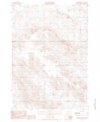
1983 Map of Grindstone SW
USGS Topo · Published 1984About this map
North Fork Bad River and its tributary system of intermittent streams carve through this Haakon County landscape, defining the rural character of the region in the early 1980s. The settlement pattern is characterized by widely dispersed family operations, including the Richard Smith Ranch and Thorson Ranch, which relied on the complex drainage network of Lone Tree Creek and Dry Creek. This survey provides a record of essential community infrastructure in a low-density ranching area, anchored by the Trinity Ch and the Alfalfa Valley Sch. The presence of these small landmarks, alongside names like the Oldenberg Ranch and Anderson Ranch, illustrates how social and educational life was organized across the vast open spaces of the West River country. The intricate topography of Lost Draw and Poeno Creek reveals the environmental constraints and water-access priorities of the era's landholders.
Find a feature on this map
12 named features on this map. Tap any name to fly to it.
Don’t see what you’re looking for? This feature index may not catch every label — zoom into the map to look around manually.
Map Details
Editions of this 1983 Grindstone SW Map
This is the sole edition of this map. No revisions or reprints were ever made.
Other maps of this area

1953 · Rapid City
USGS Topo · 1:250,000

1954 · Pierre
USGS Topo · 1:250,000

1955 · Hot Springs
USGS Topo · 1:250,000

1955 · Martin
USGS Topo · 1:250,000

1957 · Rapid City
USGS Topo · 1:250,000

1958 · Pierre
USGS Topo · 1:250,000

1958 · Martin
USGS Topo · 1:250,000

1961 · Cottonwood
USGS Topo · 1:24,000

1961 · Cottonwood NE
USGS Topo · 1:24,000
1961 · Wall NE
USGS Topo · 1:24,000