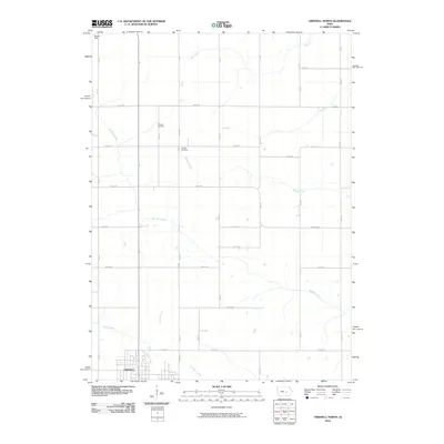
2010 Map of Grinnell North
USGS Topo · Published 2010About this map
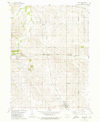
Grinnell anchors the southwest corner of this landscape, where the street grid of the college town gives way to the orderly section lines of rural Poweshiek County. The terrain is defined by a dense network of tributaries, including Big Bear Creek, Walnut Creek, and Sugar Creek, which carve gentle paths through the agricultural heartland. This 2010 survey reflects a deeply established rural infrastructure, with roads like Newburg Rd and numbered avenues following the rigid geometry of the Public Land Survey System. For local history and genealogy, the Chester Cemetery stands as a significant landmark in the northern portion of the quadrangle, serving as a focal point for the surrounding farming community. Farther north, Esbeck Field and the headwaters of Abes Fork illustrate the transition into the more open spaces of central Iowa.
Find a feature on this map
36 named features on this map. Tap any name to fly to it.
Don’t see what you’re looking for? This feature index may not catch every label — zoom into the map to look around manually.
Map Details
Editions of this 2010 Grinnell North Map
This is the sole edition of this map. No revisions or reprints were ever made.
Other maps of this area

1954 · Des Moines
USGS Topo · 1:250,000

1956 · Des Moines
USGS Topo · 1:250,000

1957 · Des Moines
USGS Topo · 1:250,000

1969 · Des Moines
USGS Topo · 1:250,000

1979 · Grinnell South
USGS Topo · 1:24,000
1979 · Malcom
USGS Topo · 1:24,000

1980 · Newburg
USGS Topo · 1:24,000
1980 · Montour
USGS Topo · 1:24,000
1980 · Tama
USGS Topo · 1:24,000
1980 · Gilman
USGS Topo · 1:24,000