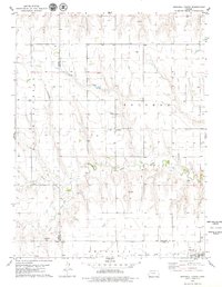
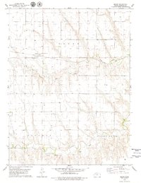
1979 Map of Grinnell North
USGS Topo · Published 1979About this map
Angelus and the surrounding plains of the High Plains region define this late-1970s landscape, where agriculture and infrastructure meet at the intersection of several county lines. The map reveals a highly organized section-line road grid spanning Thomas and Sheridan counties, punctuated by rural landmarks such as St Johns Cem. The southern edge of the survey is anchored by the community of Grinnell and the smaller settlement of Campus, both situated along the vital Union Pacific railroad corridor. Water management and resource extraction are central themes here, evidenced by the winding path of the South Fork North Solomon River and numerous scattered sites labeled Well and Oil Well. The presence of industrial activity is further noted through several Gravel Pits, reflecting the area's local economic drivers during this era.
Find a feature on this map
15 named features on this map. Tap any name to fly to it.
Don’t see what you’re looking for? This feature index may not catch every label — zoom into the map to look around manually.
Map Details
Editions of this 1979 Grinnell North Map
This is the sole edition of this map. No revisions or reprints were ever made.
Other maps of this area

1954 · Goodland
USGS Topo · 1:250,000

1956 · Goodland
USGS Topo · 1:250,000

1957 · Goodland
USGS Topo · 1:250,000

1979 · Menlo
USGS Topo · 1:24,000
1979 · Oakley South
USGS Topo · 1:24,000
1979 · Grinnell South
USGS Topo · 1:24,000

1979 · Grinnell NE
USGS Topo · 1:24,000
1979 · Sunny Slope Lake
USGS Topo · 1:24,000

1979 · Oakley North
USGS Topo · 1:24,000
1979 · Seguin
USGS Topo · 1:24,000