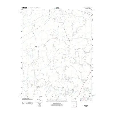
2010 Map of Grissom
USGS Topo · Published 2010About this map
Grissom and Pocomoke anchor this rural landscape in the northern reaches of the county, where the piedmont terrain is defined by a dense network of creek valleys and small water impoundments. The 2010 topography shows a transition from the historic agricultural crossroads of New Light to more modern residential patterns, yet the geography remains dominated by water systems like Smith Creek and New Light Creek. In the south, the expansion of Falls Lake marks the edge of the quadrangle, while smaller local landmarks like Efland Millpond and Masons Pond Dam highlight a legacy of small-scale water management. Genealogists and local historians can trace family-named roads and sites such as Calvin Ray Pond and Camp Kanata, alongside numerous rural branches including Buckhorn Creek and Middle Creek that have shaped the settlement patterns of these communities for generations.
Find a feature on this map
68 named features on this map. Tap any name to fly to it.
Don’t see what you’re looking for? This feature index may not catch every label — zoom into the map to look around manually.
Map Details
Editions of this 2010 Grissom Map
This is the sole edition of this map. No revisions or reprints were ever made.
Other maps of this area

1943 · Raleigh
USGS Topo · 1:62,500

1943 · Creedmoor
USGS Topo · 1:62,500

1944 · Creedmoor
USGS Topo · 1:62,500

1951 · Raleigh
USGS Topo · 1:62,500

1953 · Raleigh
USGS Topo · 1:250,000

1953 · Greensboro
USGS Topo · 1:250,000

1954 · Greensboro
USGS Topo · 1:250,000

1954 · Raleigh
USGS Topo · 1:250,000

1962 · Greensboro
USGS Topo · 1:250,000

1966 · Greensboro
USGS Topo · 1:250,000