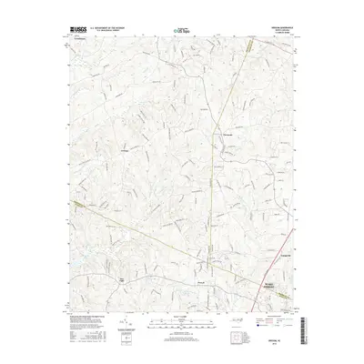
2016 Map of Grissom
USGS Topo · Published 2016About this map
The rolling landscape of the North Carolina Piedmont is captured here at the convergence of Wake, Granville, and Franklin counties. Centered around the small settlements of Grissom and Pocomoke, the map reveals a rural geography increasingly defined by residential growth near Wake Forest. Significant water features like Smith Cr and New Light Cr drain the central region, while several managed water bodies such as Brinkley Lake, Culvin Ray Pond, and Masons Pond indicate local land use patterns. This area, historically rooted in agriculture, shows a dense network of country roads including Bold Run Hill Rd and Mangum Dairy Rd, which connect the older community centers of New Light and Purnell to the larger hubs of Youngsville and Creedmoor. The protected greenery of Granville Woods provides a distinct break in the developed topography.
Find a feature on this map
158 named features on this map. Tap any name to fly to it.
Don’t see what you’re looking for? This feature index may not catch every label — zoom into the map to look around manually.
Map Details
Editions of this 2016 Grissom Map
This is the sole edition of this map. No revisions or reprints were ever made.
Other maps of this area

1943 · Raleigh
USGS Topo · 1:62,500

1943 · Creedmoor
USGS Topo · 1:62,500

1944 · Creedmoor
USGS Topo · 1:62,500

1951 · Raleigh
USGS Topo · 1:62,500

1953 · Raleigh
USGS Topo · 1:250,000

1953 · Greensboro
USGS Topo · 1:250,000

1954 · Greensboro
USGS Topo · 1:250,000

1954 · Raleigh
USGS Topo · 1:250,000

1962 · Greensboro
USGS Topo · 1:250,000

1966 · Greensboro
USGS Topo · 1:250,000