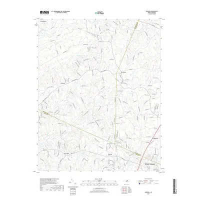
2019 Map of Grissom
USGS Topo · Published 2019About this map
Grissom and Pocomoke serve as central nodes in this rural landscape where the boundaries of Granville, Wake, and Franklin Counties converge. The terrain is defined by a dense network of tributaries including Smith Cr and Middle Cr, which flow through a region increasingly shaped by residential development and local thoroughfares like Brassfield Rd and Old Franklinton Rd. The map illustrates the transition from traditional agricultural lands to more modern subdivisions, yet maintains its historical footing with established communities like New Light and Purnell. Along the southern and eastern edges, the influence of growing municipalities is clear as the map reaches toward the outskirts of Youngsville and Wake Forest. Significant landmarks such as Calvin Ray Pond and the winding course of New Light Cr provide a detailed look at the hydrology that has historically anchored these Piedmont settlements.
Find a feature on this map
186 named features on this map. Tap any name to fly to it.
Don’t see what you’re looking for? This feature index may not catch every label — zoom into the map to look around manually.
Map Details
Editions of this 2019 Grissom Map
This is the sole edition of this map. No revisions or reprints were ever made.
Other maps of this area

1943 · Raleigh
USGS Topo · 1:62,500

1943 · Creedmoor
USGS Topo · 1:62,500

1944 · Creedmoor
USGS Topo · 1:62,500

1951 · Raleigh
USGS Topo · 1:62,500

1953 · Raleigh
USGS Topo · 1:250,000

1953 · Greensboro
USGS Topo · 1:250,000

1954 · Greensboro
USGS Topo · 1:250,000

1954 · Raleigh
USGS Topo · 1:250,000

1962 · Greensboro
USGS Topo · 1:250,000

1966 · Greensboro
USGS Topo · 1:250,000