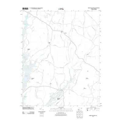
2011 Map of Grist Mountain
USGS Topo · Published 2011About this map
High Rock Lake dominates the western edge of this landscape, its fingers reaching into the surrounding Davidson County countryside through inlets like Abbotts Creek and Buddle Branch. The area is characterized by a network of rural settlements and family-named landmarks that speak to the local genealogy of the region. Cedar Grove and Silver Hill sit central to the sheet, while the terrain rises in the southeast at Grist Mountain and Wildcat Mountain.
Find a feature on this map
66 named features on this map. Tap any name to fly to it.
Don’t see what you’re looking for? This feature index may not catch every label — zoom into the map to look around manually.
Map Details
Editions of this 2011 Grist Mountain Map
This is the sole edition of this map. No revisions or reprints were ever made.
Other maps of this area

1949 · High Rock
USGS Topo · 1:24,000

1949 · Denton NW
USGS Topo · 1:24,000

1950 · Lexington East
USGS Topo · 1:24,000

1950 · Lexington West
USGS Topo · 1:24,000

1951 · Lexington East
USGS Topo · 1:24,000

1951 · Lexington West
USGS Topo · 1:24,000

1951 · Fair Grove
USGS Topo · 1:24,000

1953 · Charlotte
USGS Topo · 1:250,000

1954 · Charlotte
USGS Topo · 1:250,000

1957 · Denton
USGS Topo · 1:62,500