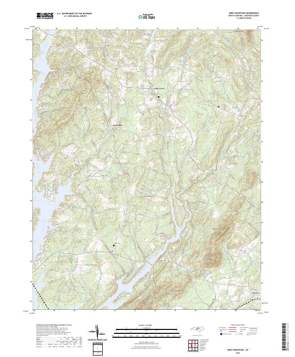
2022 Map of Grist Mountain
USGS Topo · Published 2022About this map
Silver Hill and Cedar Grove anchor the central landscape of this Davidson County survey, situated among a series of prominent peaks and winding creek beds. The terrain is defined by the significant elevations of Grist Mtn, High Rock Mtn, and Wildcat Mtn, which overlook the complex drainage systems of Flat Swamp Creek and Abbotts Creek. Local genealogy and land use are evident through family-named landmarks and historical sites such as Workman Cem and Owens Cem, while the southern edge of the quadrangle reaches toward the town of Denton. The map documents a dense network of secondary roads and trails, including S Miners Trl and Old Mountain Rd, reflecting the rural development and navigational patterns of the region.
Find a feature on this map
112 named features on this map. Tap any name to fly to it.
Don’t see what you’re looking for? This feature index may not catch every label — zoom into the map to look around manually.
Map Details
Editions of this 2022 Grist Mountain Map
This is the sole edition of this map. No revisions or reprints were ever made.
Other maps of this area

1949 · High Rock
USGS Topo · 1:24,000

1949 · Denton NW
USGS Topo · 1:24,000

1950 · Lexington East
USGS Topo · 1:24,000

1950 · Lexington West
USGS Topo · 1:24,000

1951 · Lexington East
USGS Topo · 1:24,000

1951 · Lexington West
USGS Topo · 1:24,000

1951 · Fair Grove
USGS Topo · 1:24,000

1953 · Charlotte
USGS Topo · 1:250,000

1954 · Charlotte
USGS Topo · 1:250,000

1957 · Denton
USGS Topo · 1:62,500